MipMap Desktop - Make Industrial-Grade Photogrammetry Solution More Accessible
Imagine:
- 🏗️ Engineers capture 20-minute drone footage, reconstruct with MipMap software, instantly see construction progress compared to previous records, with measurable key data and comprehensive digital archiving
- 📐 Surveyors need no complex setup or extensive software training - the software automatically handles most complex configurations, achieving survey-grade 3D results with one click
- 🎮 Content creators quickly transform real scenes into 3D content assets for AR/VR and games
This is MipMap Desktop — not just software, but your partner in productivity enhancement and digital transformation.
🎯 Design Philosophy: Enabling More People to Easily Enjoy the Productivity Boost from Photogrammetry Technology
🌍 Breaking Language Barriers - Seamless Global Access
MipMap Desktop supports 12 languages. We strive to let you operate professional photogrammetry software easily in your native language.
From software interface to documentation, comprehensive multilingual support ensures language is no longer a barrier to mastering advanced technology.
🎯 Minimalist User Experience - Simplifying Complex Technology
Traditional photogrammetry software requires deep professional background and complex parameter settings. MipMap Desktop automatically optimizes processing workflows through intelligent algorithms:
-
Smart Camera Calibration - Automatically recognizes DJI camera parameters without manual input
-
Adaptive Processing - Automatically selects optimal data processing strategies based on data characteristics
Even without a photogrammetry background, you can quickly master the software operation and produce professional-grade results in most cases.
💰 Ultimate Cost-Performance Ratio - Making Advanced Technology Accessible
🚀 Ultra-High Processing Efficiency
Speed redefined: 2–5× competing solutions
💻 Hardware-Friendly Requirements
Runs efficiently on regular gaming PCs:
- GPU: NVIDIA graphics card with VRAM > 4GB
- Memory: >16GB
Fully optimized 3D reconstruction algorithm engine maximizes your hardware performance - no expensive workstations needed for rapid results.
📊 Reasonable Subscription Fees
Compared to similar professional software with annual fees of tens of thousands, MipMap Desktop offers flexible subscription plans that SMEs, startups, and even individuals can easily afford.
🏆 Three Core Application Scenarios
📐 Aerial Survey: Professional Yet Simple
Centimeter-Level Accuracy Results
Integrated DJI RTK/GPS positioning accuracy data auto-parsing, supports ground control point optimization, easily achieving centimeter-level precision reconstruction with or without control points.
Seamless DJI Integration
Automatically reads DJI drone metadata including:
- RTK positioning information
- Camera parameters
- Shooting attitude
No configuration needed - just import photos to start processing.
Intelligent Control Point Management
- Smart Assisted Point Marking - Automatically predicts control point positions
- Accuracy Reports - Displays control point residuals
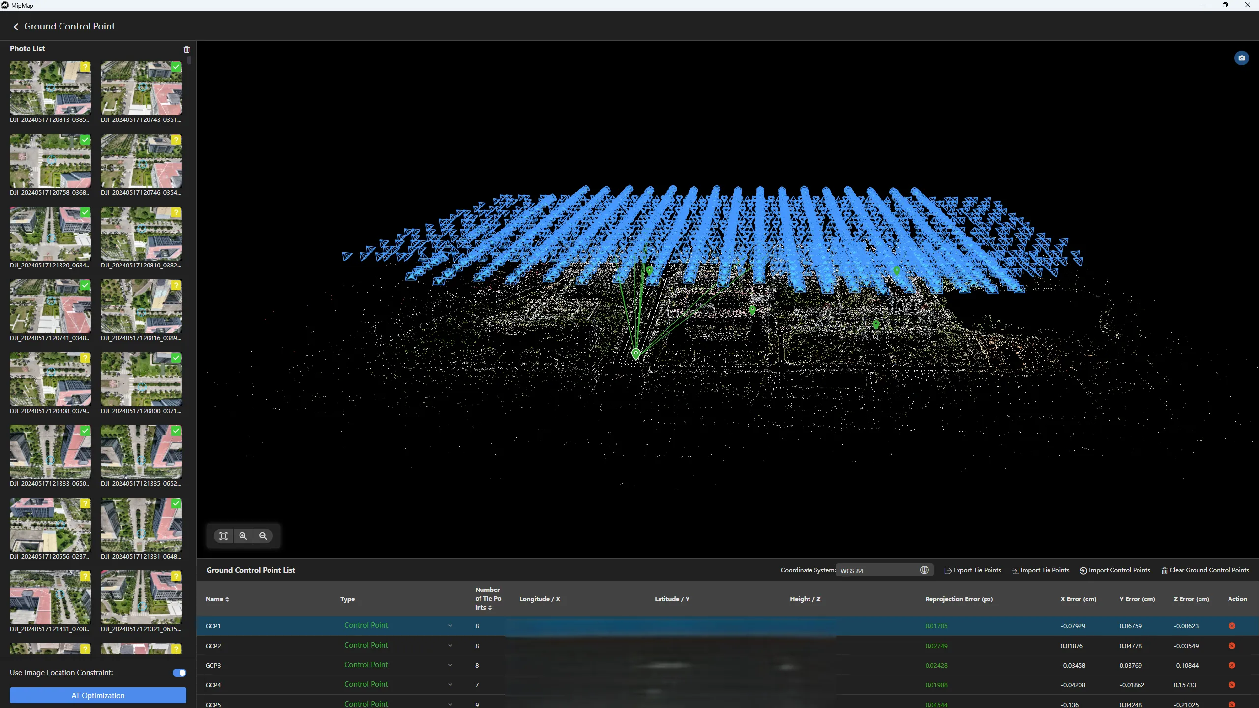
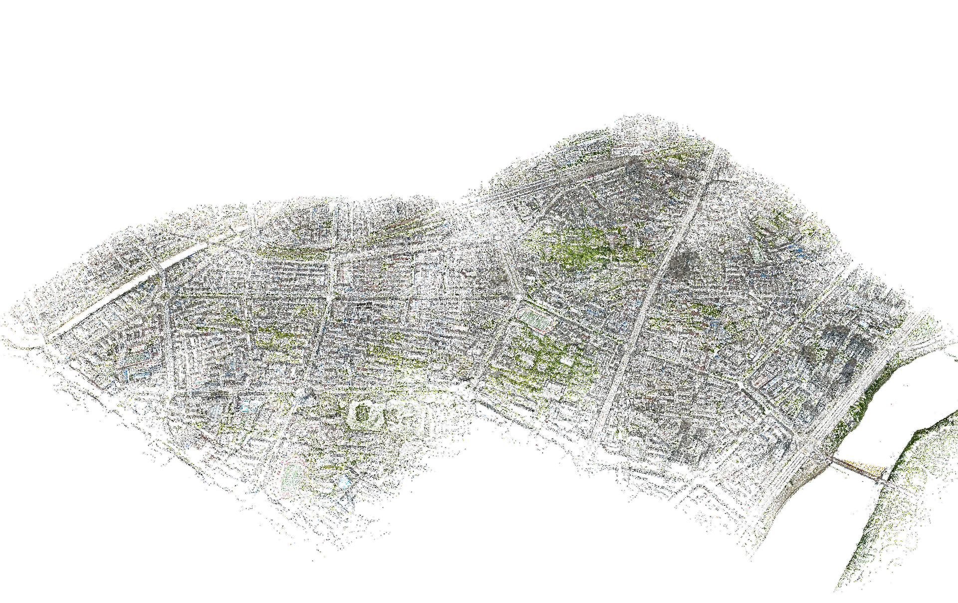
City-Scale Data Processing
Extreme memory efficiency and intelligent blocking technology enable single-machine processing of massive data (tested processing aerial 60276 images with 16 GB free RAM):
- Adaptive memory management
- Custom task blocking
- Resume from breakpoint support
🏗️ AEC Industry: Full Project Lifecycle Management
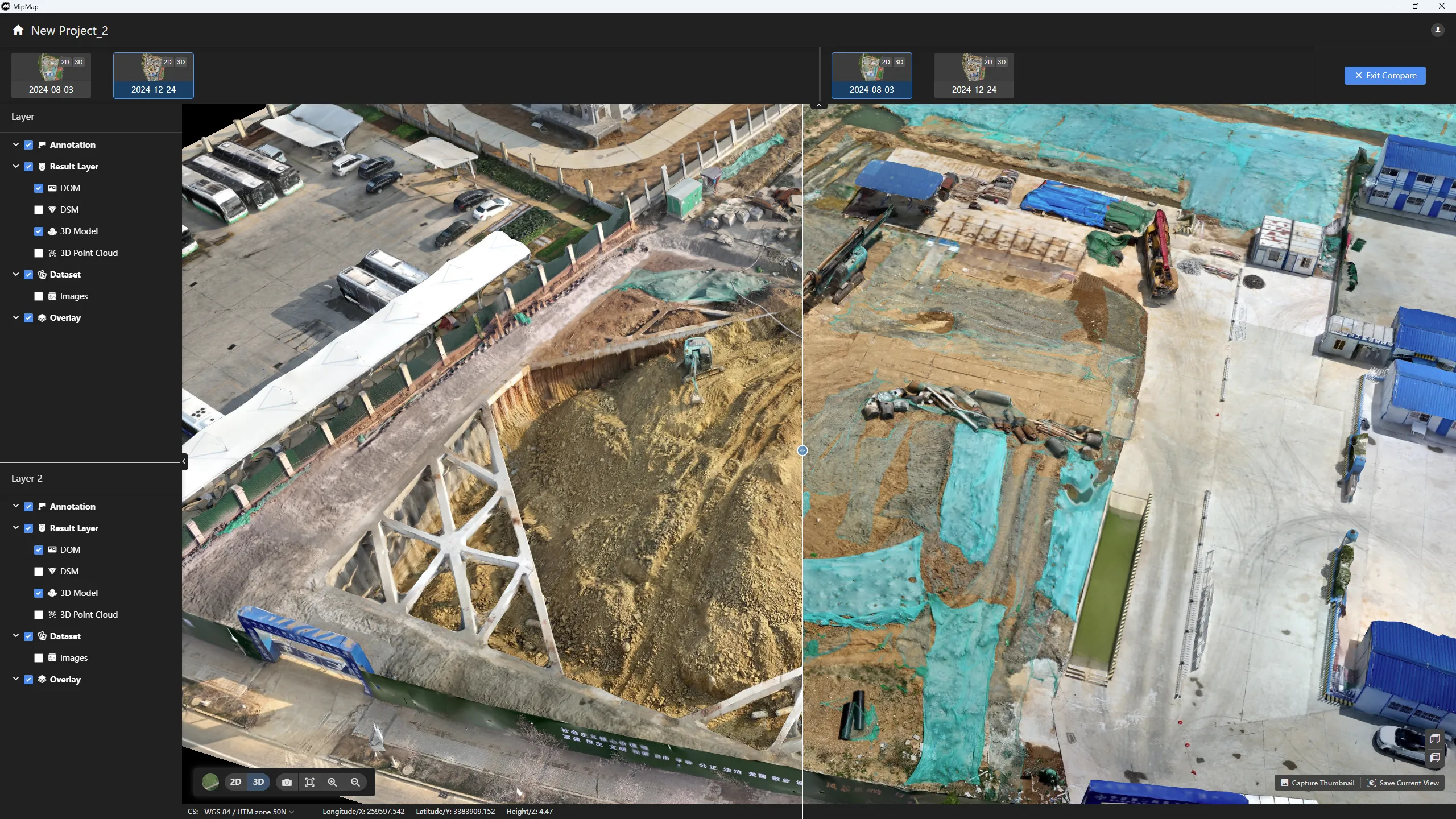
Temporal Monitoring - Changes at a Glance
Unique temporal task management for easy project progress tracking:
- Temporal Tasks - Project-based temporal task management design greatly simplifies task management throughout the project cycle
- Temporal Comparison - Built-in swipe tool makes multi-period data comparison crystal clear
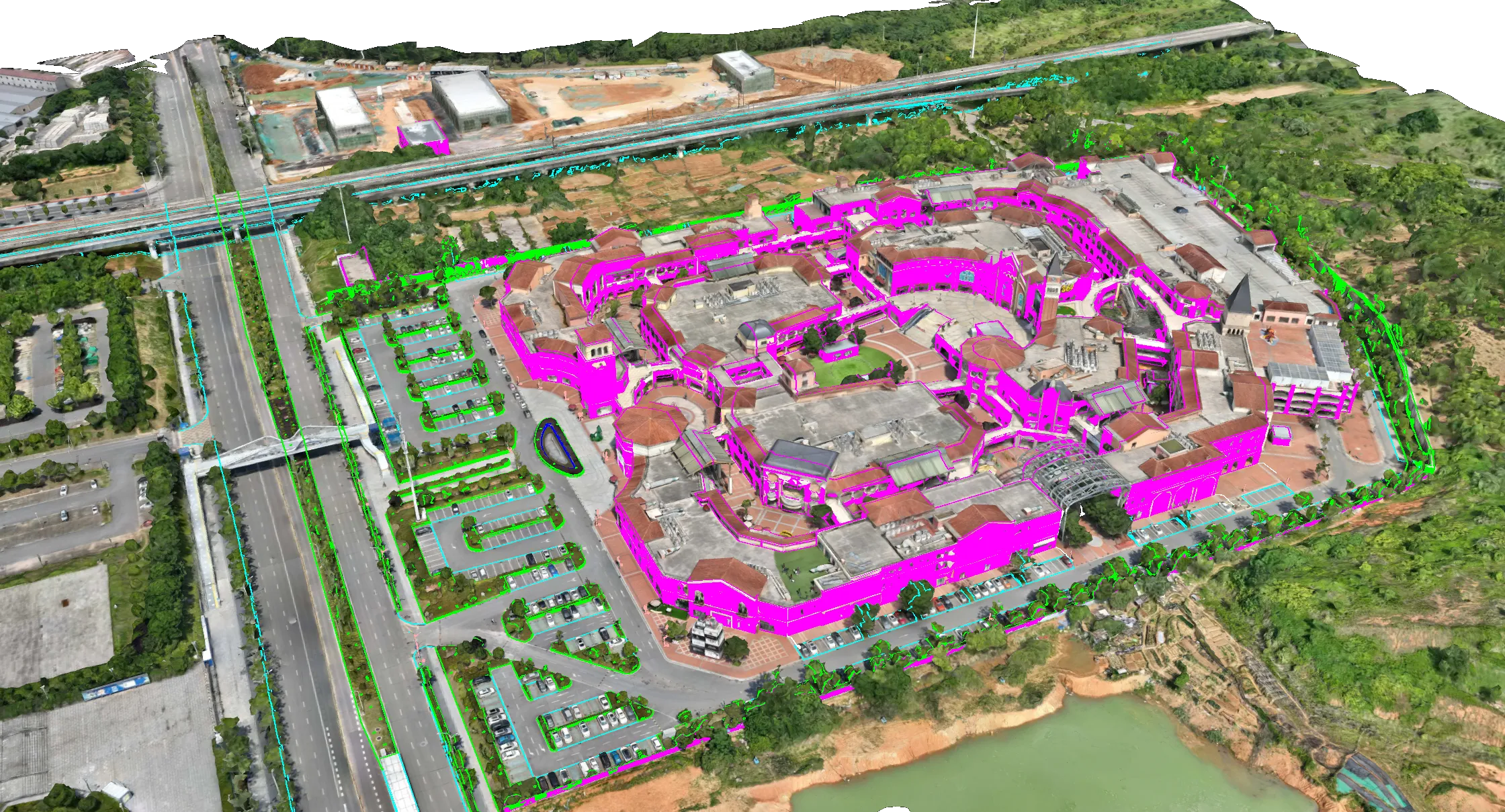
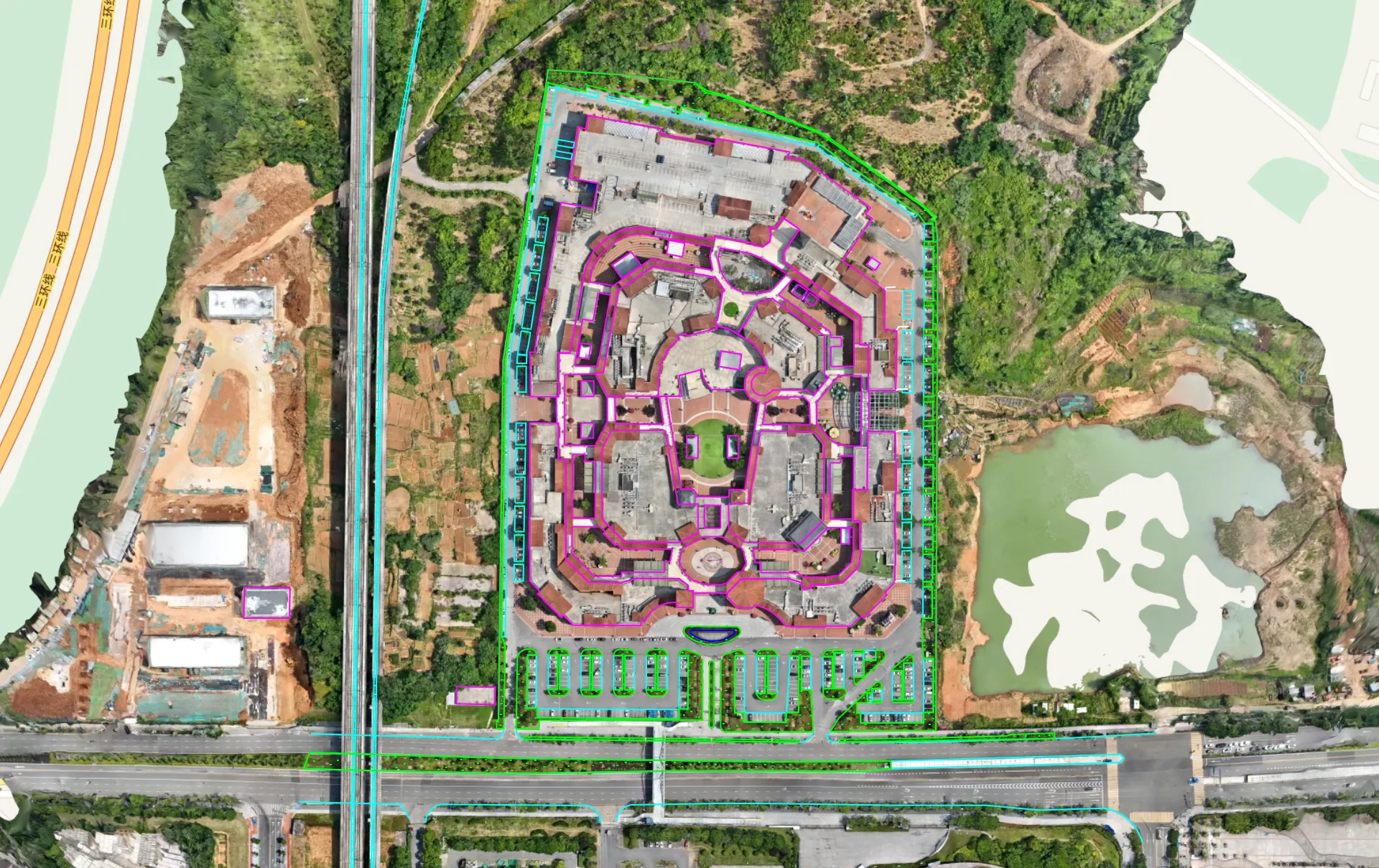
CAD Drawing Overlay - Compare Design with Reality
Supports importing DWG, DXF and other design drawings to achieve:
- Design visualization overlaid with surrounding environment
- Quick discovery of construction deviations
- Reality and design fusion display
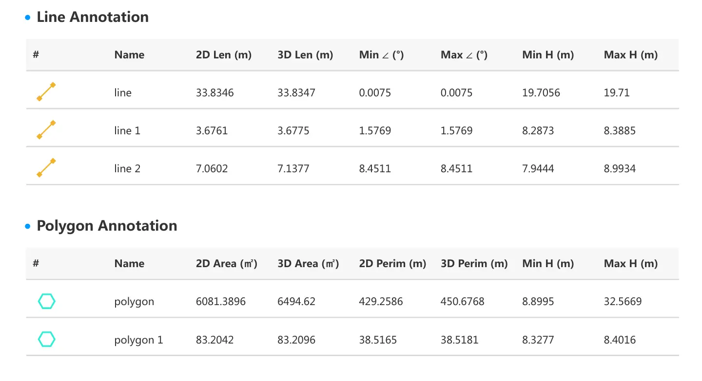
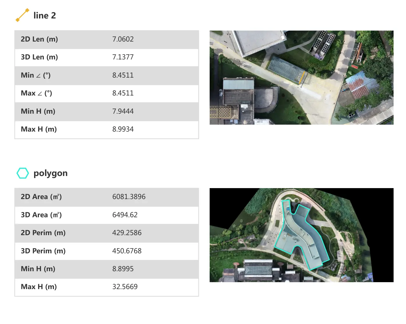
Smart Annotation & Measurement - Enhanced Collaboration
Comprehensive annotation and measurement tools:
- 📍 Point Annotation - Mark key positions for defect annotation and collaboration
- 📏 Distance Measurement - Precise length measurement
- 📐 Area Calculation - Automatic area calculation
- 📊 Volume Calculation - Accurate earthwork calculation (coming soon)
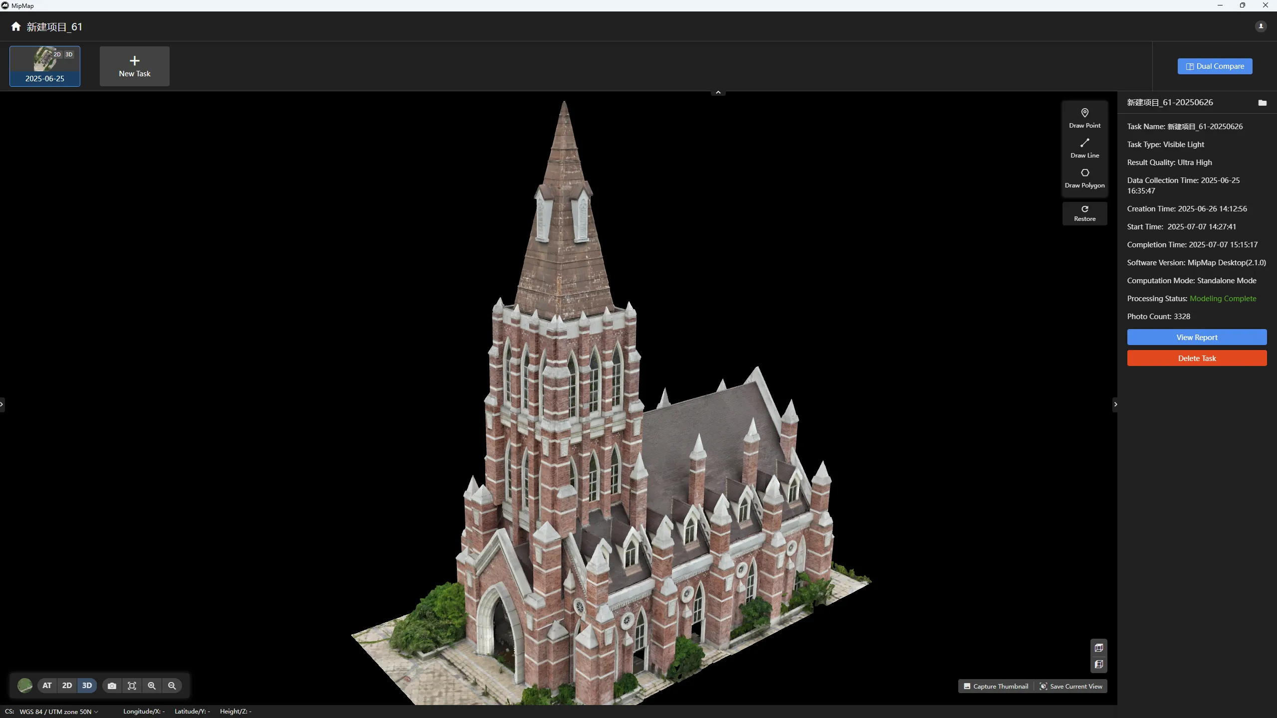
Professional Report Output
One-click generation of PDF reports containing all annotations, measurements, and analysis results for:
- Construction progress reporting
- Quality issue documentation
- Key data archiving
🎮 Content Creation: From Reality to Virtual
Multi-Device Capture Support
Supports not only professional drones but also everyday devices:
- 📱 Phone Capture - Supports latest phone high-resolution cameras
- 📷 DSLR Cameras - Supports high-resolution image input without high-precision GPS data
- 🎥 Video Extraction - Automatically extracts keyframes from video
Game Engine Ready
Output options optimized for game and VR/AR development:
- Smart Decimation - Maintains visual quality while optimizing polygon count
- Texture Packing - Maximizes texture space utilization
- Multi-LOD Generation - Automatically generates different detail levels
- FBX/OBJ Formats - Software reconstruction directly outputs formats widely supported by game engines and 3D content production tools
💪 Core Technical Advantages
⚡ 2D+3D model generate performance test case
| # images (pixels) | time cost | PC hardware |
|---|---|---|
| 5656 (20MP) | 8.78h | i7-14700KF+RTX 4070 Ti SUPER |
| 3328 (20MP) | 4.26h | i7-14700KF+RTX 4070 Ti SUPER |
| 1158(20MP) | 1.3h | i9-19000K + RTX 4090 |
tested with config
🧠 Intelligent Optimization
- Automatic Dynamic Object Removal - Intelligent vehicle and pedestrian removal
- Smart Color Balancing - Automatic handling of lighting inconsistencies
- Adaptive Blocking - Automatic optimization based on hardware
🚀 Three Steps to Get Started
1️⃣ Install Software
Download the installer, one-click installation, complete deployment in 5 minutes.
2️⃣ Import Data
Drag and drop photo folders, automatically recognizes camera parameters.
3️⃣ Start Processing
Select output type, click start, wait for results generation.
It's that simple!
🎯 Experience Now
🆓 30-Day Free Trial
Unlimited features, experience all professional functions
📚 Free Training Resources
- User manual
- Sample data
💬 Professional Technical Support
- Email support
Download Trial Now | View Related Videos
MipMap Desktop - Make Industrial-Grade Photogrammetry Solution More Accessible