6.1 Create Annotation
You can create annotations on the map using the annotation buttons in the upper right corner of the map to measure the spatial information of the map. Currently, it supports creating three types of annotations: points, lines, and polygons. It should be noted that only data containing location information can be used to create annotations. If the photos do not contain location information, you will only be able to view the 3D model and cannot perform measurements.
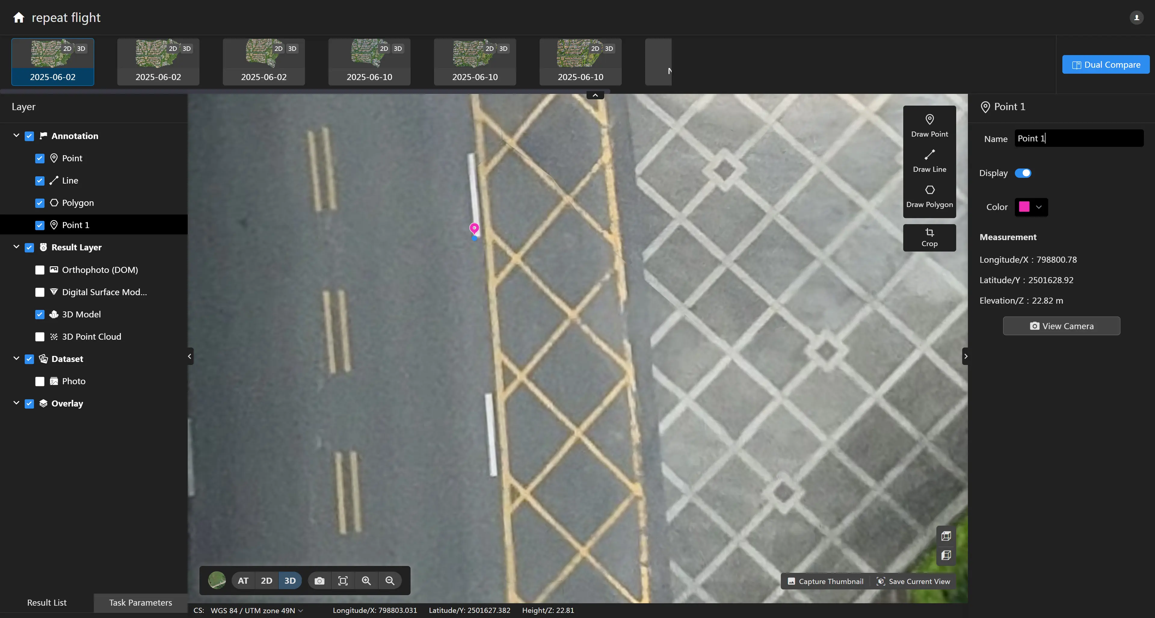
Point Annotation
Click the "Mark Point" tool  to mark a point on the map. The right panel will display the elevation information of the point. You can modify the name and color of the point annotation in the right panel.
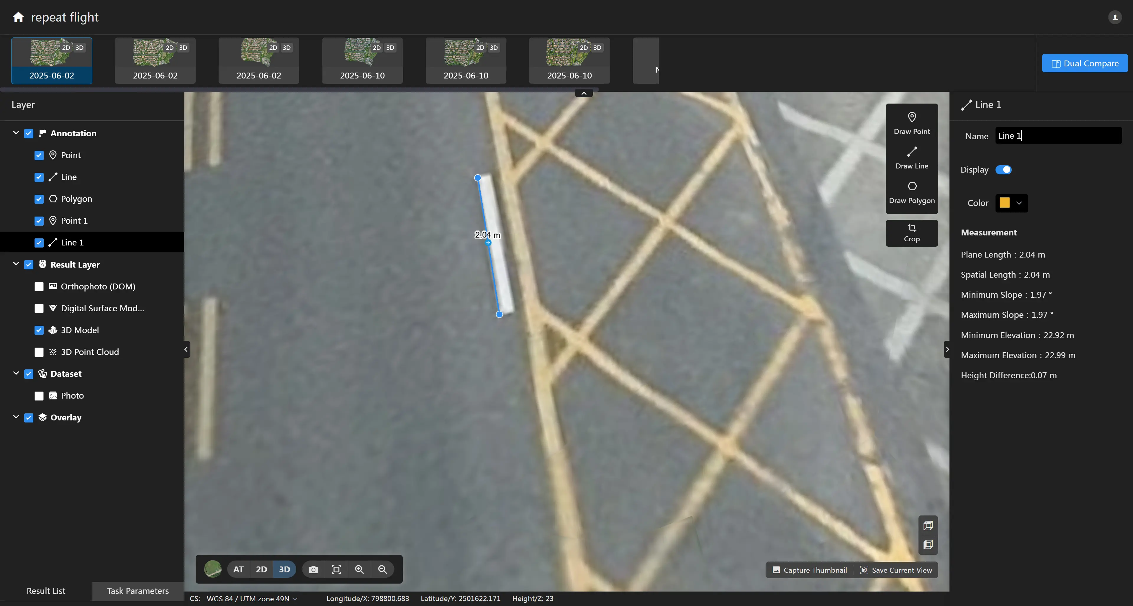
Line Annotation
Click the "Mark Line" tool ![]() to draw a continuous polyline on the map. The right panel will display information such as the planar length, spatial length, minimum slope, maximum slope, minimum elevation, maximum elevation, and elevation difference of the line segment. You can modify the name and color of the annotation in the right panel.
to draw a continuous polyline on the map. The right panel will display information such as the planar length, spatial length, minimum slope, maximum slope, minimum elevation, maximum elevation, and elevation difference of the line segment. You can modify the name and color of the annotation in the right panel.
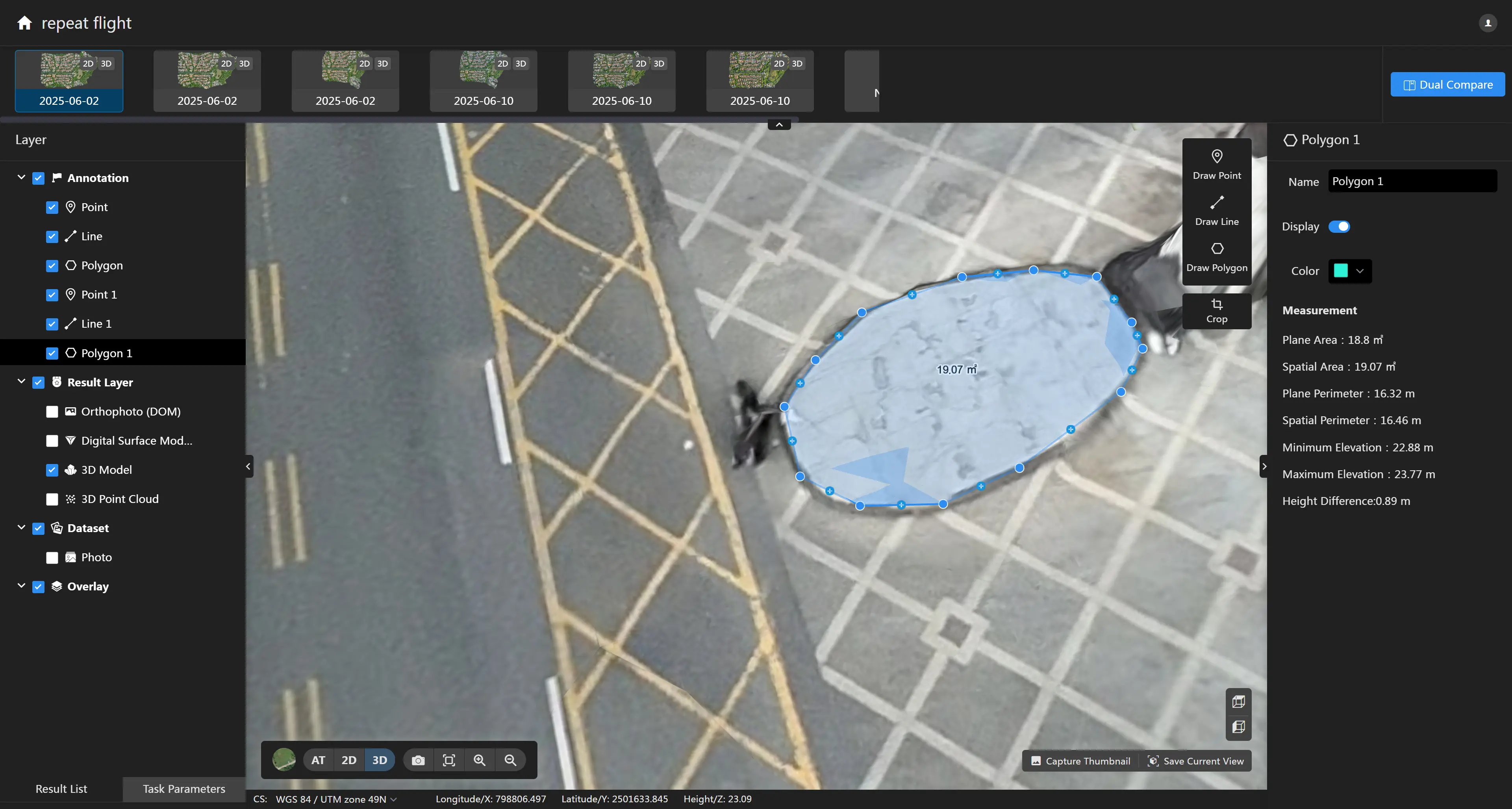
Polygon Annotation
Click the "Mark Polygon" tool ![]() to draw a closed polygon on the map. The right panel will display information such as the planar area, spatial area, planar perimeter, spatial perimeter, minimum elevation, maximum elevation, and elevation difference of the polygon. You can also modify the name and color of the annotation in the right panel.
to draw a closed polygon on the map. The right panel will display information such as the planar area, spatial area, planar perimeter, spatial perimeter, minimum elevation, maximum elevation, and elevation difference of the polygon. You can also modify the name and color of the annotation in the right panel.